_edited.png)
AI-Based Crop Insurance Changes Claim Process in Hailstorm-Hit Vidarbha
- thenewsdirt

- May 14, 2025
- 6 min read
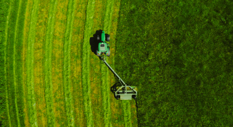
Unexpected weather events continue to affect farmers across several regions in Maharashtra. For years, the insurance process that followed such damage involved delays, uncertainty, and disputes.
With the increasing frequency of hailstorms in districts like Akola and Yavatmal, the need for a faster and more structured claims process became urgent. In response, India’s crop insurance assessment approach has undergone a major shift.
A new technology-based system has been introduced to reduce the time taken for claim settlements and improve the accuracy of loss detection.
The new approach falls under the Pradhan Mantri Fasal Bima Yojana (PMFBY), which now includes automated tools such as satellite imagery, remote sensing, and artificial intelligence to assist in loss estimation.
This is being gradually rolled out across states, and Maharashtra is among those that have incorporated it in high-risk areas, including the hailstorm-prone zones of Vidarbha.
The policy uses indicators like vegetation indices and mobile-uploaded photographic evidence to confirm damage. The integration of these tools is expected to reduce manual field inspections and accelerate payments to farmers.
Technology in the Insurance Process
The earlier method of damage verification was built around manual surveys, crop cutting experiments, and physical verification. These processes often led to inconsistencies, delays, and, in some cases, underreporting of losses.
The updated system depends on regular satellite monitoring. If a hailstorm strikes, satellite images taken before and after the event are analysed to track changes in vegetation health using indices such as NDVI (Normalised Difference Vegetation Index).
The NDVI value is one of the key indicators now used in assessment. When vegetation shows a measurable drop in NDVI following a reported disaster, it signals crop damage. In areas like Akola and Yavatmal, this has allowed for a more uniform understanding of the scale of damage.
The Mahalanobis National Crop Forecast Centre is among the institutions supporting the implementation of these models at the national level, while state-level departments adapt the technology to their specific crop cycles and geographies.
An important component introduced alongside satellite monitoring is YES-TECH, a system that estimates yield using a blend of satellite data, weather trends, and AI models. In the Kharif 2023 season, states implemented this technology with an assigned 30 percent weight in final insurance claim calculations. Results indicated that this system led to timely claims processing with no major disputes reported during the pilot period.
Maharashtra has also deployed a hailstorm reporting app. Using this Android-based application, farmers or officials can upload photographs of affected crops with GPS tagging and time stamps.
These images are matched with weather reports and satellite data. ISRO supports the backend by managing the image processing and data collation on platforms like Bhuvan. The photographic evidence further helps confirm the location and intensity of the reported damage.
The claim settlement is completed through DigiClaim, a module in the National Crop Insurance Portal (NCIP). This tool calculates claim amounts based on the verified data and releases payments through the government’s Public Financial Management System. Once approved, the compensation is directly transferred to the farmer’s account, removing the need for physical paperwork or follow-up with officials.
Implementation in Vidarbha

Vidarbha experiences hailstorms frequently during both the rabi and pre-monsoon periods. In April 2024, over 36,000 hectares of agricultural land across five districts in Vidarbha, including Akola and Yavatmal, were affected by unseasonal storms. Crops like wheat and chana, which were nearing harvest, suffered significant damage.
In the past, compensation for such damage was often delayed due to slow verification, lack of photographic evidence, and disputes over the actual extent of loss. The updated policy structure is intended to replace that process with quicker and more uniform procedures.
Under the new setup, the satellite passes over Maharashtra every seven days during the cropping season. After a weather event like a hailstorm, the NDVI values for the affected villages are checked.
If a measurable decline is found, it is taken as an indicator of damage. At the same time, farmers can upload photographs of their affected plots using the hailstorm app, and this visual evidence is used to cross-verify the satellite findings.
Ground teams now conduct inspections only in areas flagged by the system. This significantly reduces the workload and speeds up the process. Claims are calculated digitally through DigiClaim, which connects the assessment records with the payment infrastructure. In some cases, farmers have received compensation within days of assessment, which was not possible under the earlier framework.
This technology-based system is also intended to reduce variation in compensation across different farms and villages. Since satellite-based indices provide data at a fixed resolution, the claim calculation becomes more standardised.
Farmers in similar situations receive similar outcomes, subject to the same data interpretations. With NDVI as the central indicator, decisions are less dependent on individual surveyor judgement or physical proximity to administrative offices.
The photographic verification process strengthens the system further. Each image uploaded through the app includes metadata such as date, time, and coordinates, which ensures authenticity. District officials use this information in their final approval before initiating the payment release.
The Maharashtra government has also added tools like CROPIC (Collection of Real-time Photos and Observations of Crops) to supplement ground verification with photographic inputs, particularly for crop type validation and sowing confirmation.
Limitations and Operational Issues
Despite improvements, there are limits to the current system. Hailstorms are often accompanied by thick cloud cover, which affects satellite visibility.
If clouds block the view during critical post-event days, the satellite may not detect the full extent of damage. While newer satellite technology and the use of radar can reduce this issue, the risk of incomplete detection remains, especially in small time windows.
There is also the issue of resolution. Satellite data typically works at a resolution of 10 to 30 metres. This means damage confined to small patches within a field or marginal changes across tiny plots may not register clearly.
As a result, some farmers may not meet the damage threshold set by the index, even if they experience crop loss on the ground. The system relies on a calibrated NDVI cutoff, and any result below that cutoff may lead to claim rejection. This can cause dissatisfaction if farmers believe their losses are genuine but undetected by the index.
Stage-specific interpretation of NDVI is another technical challenge. Crops at different growth stages reflect different levels of vegetation health. A newly planted crop may have a naturally low NDVI, while a fully grown crop has higher readings. After a storm, both may register a decline, but the actual impact may vary.
The AI models used in YES-TECH and other tools must adjust for these variations to provide consistent assessments.
Digital literacy is a concern in certain parts of Vidarbha. Although many farmers use mobile phones, fewer are familiar with uploading images, tagging locations, or accessing portals.
Government outreach campaigns have attempted to increase awareness, but usage rates of these tools are not yet uniform.
Local political resistance was also observed in the early stages of implementation. Some groups believed that the technology would lead to lower compensation figures or reduce the ability to influence survey outcomes. These concerns led to delays in some districts. Officials reported that once the technology produced consistent results and faster claim settlements, acceptance improved.
Infrastructure maintenance and data availability are necessary to keep the system running effectively.
The government allocated dedicated funds to support these operations, including equipment purchases, training of officers, and integration with local weather monitoring stations. However, long-term effectiveness depends on ongoing investment and coordination across state and central agencies.
Wider Use and Regional Comparisons
Maharashtra is not the only state using satellite-based crop assessment. Madhya Pradesh introduced similar NDVI-based systems earlier and served as a reference model.
The results in Madhya Pradesh showed better alignment between observed and calculated losses, and fewer disputes during claim disbursement. This helped Maharashtra adopt a similar model and adapt it to local crops and risk patterns.
Other hailstorm-prone states such as Haryana, Rajasthan, and Himachal Pradesh have begun integrating remote sensing with crop insurance processes, although the level of technology adoption varies.
Some states rely on weather-based triggers rather than vegetation indices. These parametric insurance schemes settle claims based on rainfall, hail size, or temperature, instead of measured crop damage.
The central government has been encouraging states to adopt satellite-assisted tools and expand their reach under PMFBY through 2025–26.
The Weather Information Network Data Systems (WINDS), another programme in progress, aims to expand automated weather station coverage across rural blocks.
Data from WINDS feeds into yield models and damage assessments. This creates a connected system where crop status, weather trends, and damage reports are processed together.
The use of YES-TECH and DigiClaim together is gradually becoming the national model for crop insurance. Both tools have been used in multiple states since 2023 and are expected to play a larger role in the next crop seasons.
As models improve and field feedback is incorporated, the government plans to reduce dependence on physical verification and move towards technology-supported claim validation at scale.
References
Deshmukh, N. (2025, April 27). Maharashtra govt to start using satellite images to assess crop damage and compensation. The Economic Times. https://economictimes.indiatimes.com/news/india/maharashtra-govt-to-start-using-satellite-images-to-assess-crop-damage-and-compensation/articleshow/120667860.cms
Madaan, N. (2024, April 13). Hailstorm & rain damage crops over 36k ha in Vidarbha. The Times of India. https://timesofindia.indiatimes.com/city/pune/hailstorm-rain-damage-crops-over-36k-ha-in-vidarbha/articleshow/109259711.cms
Ministry of Agriculture & Farmers Welfare. (2025, February 11). Assessment of crop losses through satellite. Press Information Bureau. https://pib.gov.in/PressReleasePage.aspx?PRID=2101838
Ministry of Agriculture & Farmers Welfare. (2025, February 17). Pradhan Mantri Fasal Bima Yojana turns nine: Empowering Annadata & Protecting Livelihoods. Press Information Bureau. https://pib.gov.in/PressReleasePage.aspx?PRID=2104175
Press Trust of India. (2015, October 5). Government unveils Kisan project; hailstorm app to assess crop damage. The Economic Times. https://economictimes.indiatimes.com/news/economy/agriculture/government-unveils-kisan-project-hailstorm-app-to-assess-crop-damage/articleshow/49226885.cms


Comments