_edited.png)
Geography of Vidarbha: Rivers, Forests, Climate and Natural Resources
- Pranay Arya

- Jan 30
- 7 min read

Vidarbha is a sprawling region in the Indian state of Maharashtra, covering roughly one-third of the state’s land area. Located in the heart of the Deccan, it is a land of broad upland plains interspersed with forests and rivers.
This region stands out for its varied terrain, from the flat, black-soil farmlands that yield cotton and oranges to the rugged hills and tiger-inhabited forests on its peripheries. Despite its size and natural wealth,
Vidarbha’s geographical position leaves it drier than Maharashtra’s coastal areas, with a climate prone to extremes. The following sections explore in detail the physical terrain, water systems, climate patterns, and natural resources that define Vidarbha’s geography.
Location and Terrain of Vidarbha
Vidarbha occupies the eastern portion of Maharashtra, bounded by Madhya Pradesh to the north, Chhattisgarh to the east, and Telangana to the south.
To the west, it borders other regions of Maharashtra, demarcated in part by tracts of hills. Geographically, Vidarbha lies on the northern segment of the Deccan Plateau, a vast tableland of volcanic origin.
Much of the region’s terrain is a gently undulating plateau underlain by ancient basalt rock from the Deccan Traps, volcanic lava flows laid down around 66 million years ago. This gives rise to the fertile black cotton soils that cover large expanses of Vidarbha’s farmland. The terrain is largely flat to rolling, but not featureless. In the north, the Satpura Range forms a series of hills marking the boundary with Madhya Pradesh. An offshoot of these hills in Melghat reaches into Vidarbha, creating a high forested tract that includes the region’s only hill station.
One of the most striking geological features of Vidarbha is the Lonar Crater Lake in Buldhana district. Lonar Lake is a nearly circular saline lake about 1.8 kilometres across and 150 metres deep, formed by a meteorite impact roughly 35,000 to 50,000 years ago.
The crater’s location in a basaltic plateau long puzzled geologists, until it was confirmed as a meteor impact site rather than a volcanic crater. This landmark highlights the region’s volcanic past and adds to its geological diversity.
The extreme eastern districts of Bhandara and Gondia differ from the rest of Vidarbha in their underlying geology.
These districts sit on ancient metamorphic rock and riverine alluvium rather than basalt, making their soil and terrain distinct within the state.
Overall, Vidarbha’s topography can be seen as a patchwork of flat plateaus, low hills, and broad river valleys, a surface influenced by both the volcanic origins of the Deccan and long-term erosion.
Rivers and Climate Patterns
Water systems play a crucial role in Vidarbha’s geography, carving out fertile valleys and sustaining agriculture. The region lies mostly within the Godavari River basin, with major rivers flowing south or east to eventually join the Godavari.
The Wardha River originates in the Satpura hills of southern Madhya Pradesh and runs southward through western Vidarbha.
To the east, the Wainganga River rises in the forests of the Mahadeo Hills and winds through the eastern districts. These two rivers meet at the southeastern boundary of Vidarbha to form the Pranhita River, which then merges into the Godavari. Along with their tributaries, such as the Penganga, the Wardha, and the Wainganga, they create broad alluvial plains that have traditionally been centres of cultivation.
In western Vidarbha, tributaries of the Tapti River like the Purna drain parts of Akola and Buldhana, but most of the region’s drainage is ultimately toward the Godavari system.
The rivers of Vidarbha are monsoonal. They swell with rain from June to September and run much lower or even dry in the summer months. Dams such as the Upper Wardha Dam have been built to harness these rivers for irrigation, but large parts of the region still depend on seasonal flow. Vidarbha’s climate is classified as tropical monsoon, but with a drier tendency than western Maharashtra.
The Western Ghats block much of the moisture from the Arabian Sea, resulting in lower rainfall. The region typically receives an average of about 800 to 1,200 millimetres of rain annually, mostly during the monsoon months. Rainfall varies across the region. Northern and eastern hill areas receive more precipitation, while western districts get less.
The monsoon’s erratic nature often leaves Vidarbha vulnerable to drought. Severe drought episodes were recorded in 1985 to 86, 2002 to 03, and 2011 to 12, each causing widespread crop failure. In between such major events, shorter dry spells are common and have become more frequent in recent decades.
Summers are long and intense. During April and May, daytime temperatures often cross 40 degrees Celsius, making Vidarbha one of the hottest parts of India. Nagpur regularly records some of the country’s highest summer temperatures.
Winters are mild and dry, with night temperatures dropping close to 10 degrees Celsius in some areas. The combination of limited rainfall and high heat makes water a central concern.
Much of Vidarbha’s agriculture is rain-fed, and irrigation coverage remains low. Groundwater is widely used for drinking and farming, but aquifers in the basalt rock are shallow and get depleted quickly in drought years. Recurrent droughts have had serious social consequences, including crop failures and economic distress across rural districts.
Forests and Wildlife
Vidarbha holds some of the most extensive forests in Maharashtra. A few eastern and northern districts contain the bulk of the state’s forest cover.
Gadchiroli, Chandrapur, and Amravati together are responsible for a major share of Maharashtra’s total forest area.
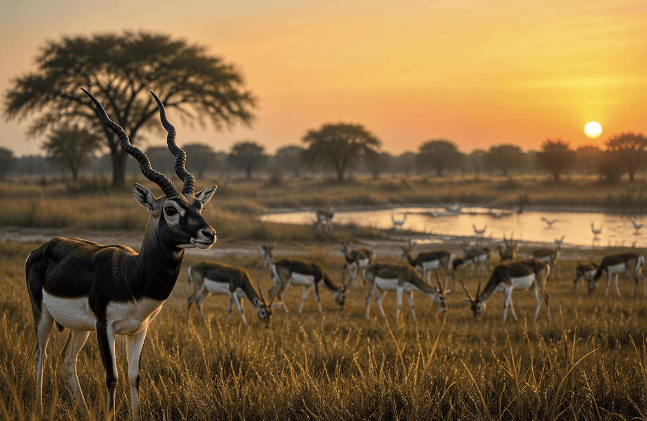
These forests range from moist deciduous tracts in the east to dry teak forests in the west. They support a wide range of wildlife, including tigers, leopards, sloth bears, gaurs, deer, and many bird species. Several important protected areas are located in the region. Tadoba–Andhari Tiger Reserve in Chandrapur is the largest national park in Maharashtra and is known for its high tiger density.
Melghat Tiger Reserve in Amravati protects a major forest system in the Satpura hills. Other sanctuaries such as Pench, Nagzira, Bor, and Tipeshwar add to the ecological network across the region.
Despite this natural wealth, forest cover in Vidarbha has faced steady pressure. Deforestation has occurred due to agricultural expansion, infrastructure projects, and mining. Chandrapur is a major coal mining district, with large open-cast mines and thermal power plants that have resulted in the clearing of forest land. Gadchiroli has also seen a significant loss of dense forest cover in recent years. In many cases, forest degradation is more serious than outright loss. Dense natural forests are being replaced with fragmented or degraded patches, even where overall tree cover figures appear stable.
Invasive plant species have also spread in several forested and wetland areas, especially in Bhandara and Gondia, where aquatic weeds have affected traditional lakes.
Forest fires have become more frequent during dry seasons. Some are accidental, while others are set deliberately for collecting forest produce.
Human–wildlife conflict has increased as animals move closer to settlements in search of food and water.
Despite these pressures, Vidarbha’s forests remain vital. They regulate local climate, support river systems, and sustain the livelihoods of tribal communities who depend on forest produce. These forests continue to be one of the most important ecological assets of the region.
Agriculture and Natural Resources
The interaction between climate, soil, and water has defined agriculture in Vidarbha. The fertile black soils derived from basalt support extensive farming. The region is one of India’s major cotton-growing belts.
Districts such as Yavatmal, Akola, Amravati, Wardha, Buldhana, and Nagpur are among Maharashtra’s top cotton producers.
Large tracts of rain-fed cotton dominate rural areas, making cotton the primary cash crop. Alongside cotton, soybean and pigeon pea are widely cultivated, while sorghum and millets are grown in drier zones.
Horticulture is another important feature. The region is famous for Nagpur oranges, grown in and around Nagpur and neighbouring districts. Citrus orchards form a key part of the rural economy, and oranges from this area are exported across India and abroad. However, citrus cultivation has become increasingly vulnerable due to changing rainfall patterns, declining groundwater levels, and rising temperatures.
Vidarbha is also rich in minerals. Coal, manganese, iron ore, and limestone are found across the region. The Wardha Valley Coalfield supports major mining operations in Chandrapur and Yavatmal. Manganese mining has historically been important around Nagpur and Bhandara. These activities contribute to the economy but have altered the local geography through excavation, waste dumps, and groundwater depletion. Open-cast mining has transformed parts of the terrain and affected nearby water sources.
Water resources remain uneven. Large irrigation projects exist, such as dams on the Wainganga and Wardha rivers, but overall irrigation coverage is still limited. Many farmers depend on wells and seasonal streams. The eastern districts of Bhandara and Gondia are known for their numerous lakes, which were historically used for irrigation and fishing.
These lakes continue to support agriculture and biodiversity, although many face issues such as weed infestation and siltation. Soil salinity in certain low-lying areas also affects crop productivity.
Agriculture continues to dominate the economy and daily life.
Farming practices are closely linked to seasonal cycles. Good monsoon years bring healthy crops and full reservoirs. Poor rainfall years result in dry fields and shrinking water bodies. Geography remains the strongest influence on economic stability in this region.
Vidarbha’s geography is defined by its plateaus, river systems, forests, and climatic extremes. The region’s physical setting has shaped settlement patterns, livelihoods, and resource use over centuries.
From fertile black soils to mineral-rich subsoil and dense forest tracts, the region holds both opportunity and constraint. Agriculture, mining, and forestry all depend on this geographical foundation. At the same time, limited rainfall and high temperatures impose natural limits on growth.
Vidarbha continues to exist in a close relationship with its physical surroundings, where environmental conditions remain a decisive factor in economic and social life. Understanding this geographical structure is essential for understanding how the region functions and why its challenges remain deeply rooted in the land itself.
References
Wikipedia. (2025, January 24). Vidarbha. Retrieved from https://en.wikipedia.org/wiki/Vidarbha
TheNewsDirt. (2025, April 8). From Forest Floor to Coal Dust: The Slow Erosion of Vidarbha’s Native Life. Retrieved from https://www.thenewsdirt.com/post/from-forest-floor-to-coal-dust-the-slow-erosion-of-vidarbha-s-native-life
Raghuram, M. (2024, October 12). Human-induced climate change threatens Nagpur Oranges; can this heritage be saved? Down To Earth. Retrieved from https://www.downtoearth.org.in/agriculture/dte-ground-report-human-induced-climate-change-threatens-nagpur-oranges-can-this-heritage-be-saved
Indian Brand Equity Foundation (IBEF). (2025, December). Cotton Industry and Exports. Retrieved from https://www.ibef.org/exports/cotton-industry-india
NASA Earth Observatory. (2008, April 12). Lonar Crater, India. Retrieved from https://earthobservatory.nasa.gov/images/8654/lonar-crater-india
Todmal, R. S. (2019). Droughts and Agriculture in the Semi-Arid Region of Maharashtra, Western India. Weather, Climate, and Society, 11(4), 741–754
Maharashtra Sadan. (n.d.). Geographical Profile – The Land (Maharashtra). Retrieved from https://maharashtrasadan.maharashtra.gov.in/en/geographical-profile


Comments