_edited.png)
History of Arni, Yavatmal: From River Village to Tehsil Hub
- Pranay Arya

- Dec 16, 2025
- 9 min read

Arni’s past sits at the meeting point of river, market and faith in the eastern part of Maharashtra’s Vidarbha region.
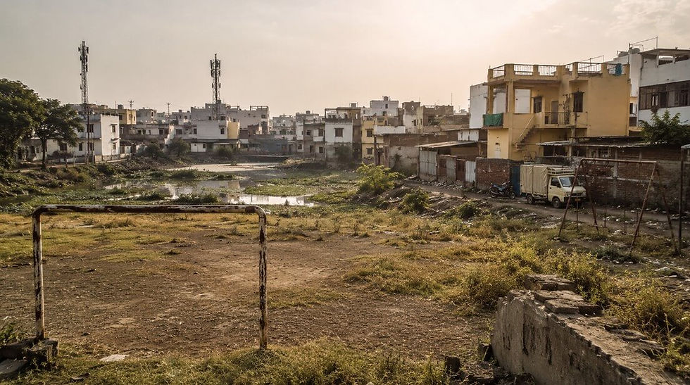
The town today serves as a tehsil headquarters in Yavatmal district and stands on the banks of the Arunavati River, a setting that has shaped both its economy and its social life over time.
Before gaining its current administrative status, Arni was recorded as a “fast growing village” in official gazetteers, already recognised for its market and fair. Over the decades it grew from that village profile into a nodal town for surrounding rural areas.
Religious institutions developed alongside this economic role and drew people from outside the immediate district. The result is a settlement where administrative, market and spiritual functions developed together rather than in isolation.
From River Village to Market Centre
The earliest detailed official snapshot of Arni comes from the Maharashtra state gazetteer for Yavatmal, which described it as a “fast growing village of 6,107 inhabitants” situated in Darvha tahsil on the Arnavati, another form of the name Arunavati.
At the time of that survey, it lay 38.62 kilometres south east of Darvha and functioned as a local market and cattle fair centre at the convergence of district and tahsil roads.
This geographic description places Arni within a transport network that linked it to larger administrative towns, while the mention of a fair and a weekly market points to a role that went beyond ordinary agrarian life.
The same gazetteer entry notes that Arni hosted a weekly market on Mondays, turning the settlement into a regular meeting point for villagers from nearby localities.
Livestock and agricultural produce moved through this market, and the cattle fair underlined its importance as a regional gathering place.
The presence of a high school, a post office and a dispensary, all listed in the gazetteer, shows that by the mid‑twentieth century Arni already possessed basic institutional infrastructure that usually marks a rural centre rather than a simple village. Water for daily use was drawn from wells and the river, anchoring the settlement’s growth to the Arunavati’s flow.
District‑level historical writing places the wider Yavatmal area within older political entities long before Arni appears in modern records.
In ancient and early medieval periods the region formed part of larger territorial units under dynasties whose control extended across much of central India, although individual villages like Arni are not named in those sources.
In later centuries, Yavatmal district fell within Berar, which came under the Nizam of Hyderabad before being taken on lease by the British in the nineteenth century.
This shift brought the area under more formalised British administrative structures, with Berar later merged into the Central Provinces and Berar, and districts including Yavatmal organised as part of that framework.
Marathi‑language material on Arni adds a local layer to this broader history. A Marathi encyclopaedic entry records that the village earlier lay in the Nizam’s dominion and was incorporated into Maharashtra when the princely states were merged after independence.
The same source explains that before 1932 the place was popularly known as “Ulti Pandhari,” a name linked in local memory to sharp changes in fortune among residents, before the present name Arni came into formal use.
This account does not appear in the English gazetteer but sits within local historical consciousness as an explanation for the change in name.
Administrative Shifts and Demographic Growth
Administrative records show how Arni’s formal status changed over time from a village within a larger tahsil to a centre in its own right.
In the gazetteer period Arni is clearly placed under Darvha tahsil, confirming that its early twentieth century administrative identity was subordinate to that larger unit.
Post‑independence reorganisation first created Bombay State and then Maharashtra in 1960, bringing Yavatmal and its settlements, including Arni, into a new state structure. Over the following decades, the state administration gradually adjusted boundaries and subdivisions to match growing populations and evolving economic patterns.
By the time of the 2011 Census, Arni had become the headquarter town of a full tehsil. Census compilations list Arni as a taluka in Yavatmal district, with Arni town as the taluka headquarter. The taluka‑level population figures for that census stand at 161,833 residents in Arni tehsil, spread across its rural and urban settlements.
Within this structure, Arni village itself, identified by census code 543235, recorded a population of 27,809 people, almost evenly divided between men and women, confirming its scale as a large settlement rather than a small hamlet.
These numbers reflect steady demographic growth over the decades. Earlier gazetteer data reported 6,107 inhabitants, while later census figures show a multiplication of that base population as Arni’s market and institutional roles drew more people.
Tabulations and village lists place Arni at the centre of a cluster of surrounding villages for which it functions as the primary service town. Recent statistical summaries compiled from census data highlight that Arni tehsil encompasses a significant number of villages, reinforcing its role as a hub for administration, trade and services.
Marathi‑language sources add specificity to this picture of regional centrality. An entry on Arni taluka notes that the taluka covers about 767 square kilometres and includes around 111 villages, which helps explain why its market is described as large and well known.
It also repeats that every Monday sees a sizeable market in the town, continuing the weekly pattern documented in the earlier gazetteer.
Together, these details show a line of continuity from the era when Arni was officially just a village under Darvha to its present status as an administrative and commercial centre with a broad rural catchment.
Market Town in an Agrarian District
Arni’s evolution as a market town is closely tied to the agrarian character of the Yavatmal district.
District profiles identify agriculture as the mainstay of the local economy, with cotton, soyabean, pulses and cereals among the principal crops.
The district has long been associated with cotton in particular, and the presence of ginning and pressing units across Yavatmal reflects this emphasis.
Within this context, Arni’s weekly market and cattle fair function took on added significance as channels for the exchange of produce and livestock from the surrounding countryside.
Official gazetteer notes that Arni commands a “nodal location” at the convergence of district and tahsil roads, which gives it an advantage as a collection and distribution point.
Produce from villages in Arni taluka and from neighbouring areas moves through the town’s markets, which offer access to traders, transporters and basic processing facilities.
Later district industrial and planning documents mention agricultural markets and cotton processing units at various centres across Yavatmal, although they describe these at district level rather than isolating detailed production figures for Arni alone.
Today’s online directories and local guides reflect the continuity of Arni’s role in this agrarian trading network. They identify the town as a place where people from nearby villages come to sell crops, purchase inputs and access services ranging from education to healthcare.
The combination of a weekly general market with seasonal peaks linked to crop harvests and the annual fair in February means that Arni’s economic rhythm follows the agricultural calendar of central Maharashtra.
Transport links help sustain this function despite the absence of a railway station in the town itself.
Mapping and descriptive sites show Arni connected by road to other towns in Yavatmal district and beyond, with the nearest railway access at stations such as Dhamangaon, and the closest major airport at Nagpur’s Dr Babasaheb Ambedkar International Airport.
Regional and tehsil maps prepared by the Maharashtra Remote Sensing Application Centre locate Arni within a network of roads that tie it to larger state and national routes, including National Highway 361, which improves the flow of goods and people through the town.
Dargah, Urs and Shared Religious Space
Alongside the market and administrative structures, Arni’s identity has been shaped strongly by a major Sufi shrine and its annual urs.
At the heart of this religious landscape stands the dargah of Hazrat Baba Kambalposh, located within the town and highlighted in multiple local descriptions as a significant site of pilgrimage and devotion.
The shrine’s own material sets out a detailed schedule for the urs, celebrated every year from 5 to 10 February, with visitors arriving from across Maharashtra as well as from Telangana and Karnataka.
Programmes during the urs are organised across several days and include qawwali performances, poetry gatherings, bhajan events and various cultural activities staged on dedicated platforms.
The dargah trust also lists social initiatives such as blood‑donation camps, free health check‑ups, eye camps and a community kitchen offering free food in the form of langar during the festival.
These details are recorded in the shrine’s published programme and are visible in coverage of the event on regional news and video platforms, which show large crowds in and around the complex during the festival period.
The Maharashtra Gazetteer, written decades earlier, already described Arni as the scene of a “large gathering” during the annual urus held in February in honour of Kamalpose Baba, using a variant of the name associated with the same Sufi figure.
This continuity between the earlier English‑language official record and the present‑day dargah documentation underlines the longstanding place of the shrine in the town’s annual cycle.
Local descriptive material notes that people from various religious communities visit the dargah, portraying it as a symbol of Hindu–Muslim unity where visitors participate in the festival regardless of religious background.
Nearby religious sites contribute further to this layered spiritual geography. Local guides mention temples in and around Arni, including shrines dedicated to Mahadev, indicating that Hindu worship has long had a presence alongside the Sufi shrine.
While the available official sources do not provide precise dates for the construction of these temples, their mention in descriptive accounts reinforces the sense of a town where multiple religious practices coexist in close proximity.
In this setting, the annual urs and other observances add ritual and cultural intensity to a place that otherwise functions as an everyday market and administrative centre.
A Town Shaped by River, Administration and Faith
Across the available documentary and local sources, Arni appears consistently as a settlement shaped by its river, its role in administrative hierarchies and its religious institutions.
The Arunavati River provided the original physical anchor for the village and remains central enough that official descriptions still begin by noting that Arni lies on its banks.
Administrative documents trace a shift from the village in Darvha tahsil to the headquarters of Arni tehsil, with census figures showing how its population increased as its market and institutional functions expanded.'
The market has tied the town’s fortunes to the broader agrarian economy of Yavatmal district. Weekly and annual gatherings have brought farmers and traders into Arni for decades, reflecting broader patterns in which rural populations cluster periodically around market and fair sites.
At the same time, the dargah of Baba Kambalposh and its urs have given Arni a spiritual profile that reaches beyond the district, drawing pilgrims, performers and volunteers from other parts of Maharashtra and neighbouring states.
Local Marathi accounts preserve memory of the town’s earlier name and its position within the Nizam’s dominion before independence, connecting Arni’s story to the wider political changes that reshaped central India in the twentieth century.
Together, these strands form a documented picture of a place that moved from a river village in a princely state to a taluka headquarter in a modern Indian district, while maintaining regular rhythms of market, worship and gathering that continue to structure daily and annual life in the town.
References
Arni. (n.d.). In Maharashtra Gazetteers: Yavatmal District – Places (English ed.). Government of Maharashtra. Retrieved from https://gazetteers.maharashtra.gov.in/cultural.maharashtra.gov.in/english/gazetteer/YAVATMAL/places_Arni.html
Arni, Maharashtra. (2009, December 4). In Wikipedia. Retrieved December 14, 2025, from https://en.wikipedia.org/wiki/Arni,_Maharashtra
Arni taluka. (2022, November 23). In Marathi Wikipedia. Retrieved December 14, 2025, from https://mr.wikipedia.org/wiki/आर्णी_तालुका
Arni village in Arni (Yavatmal) Maharashtra. (2010, December 31). VillageInfo.in. Retrieved December 14, 2025, from https://villageinfo.in/maharashtra/yavatmal/arni/arni.html
Arni village population – Arni – Yavatmal, Maharashtra. (2010, December 31). Census2011.co.in. Retrieved December 14, 2025, from https://www.census2011.co.in/data/village/543235-arni-maharashtra.html
Arni village population, caste – Arni, Yavatmal, Maharashtra. (2010, December 31). CensusIndia.co.in. Retrieved December 14, 2025, from https://www.censusindia.co.in/villages/arni-population-yavatmal-maharashtra-543235
Arni village in Arni taluka, Yavatmal, Maharashtra. (2020, December 31). Vill.co.in. Retrieved December 14, 2025, from https://vill.co.in/maharashtra/yavatmal/arni-510040880/arni-040885432350/
Arni taluka. (2025, July 31). OneFivenine. Retrieved December 14, 2025, from http://www.onefivenine.com/india/villag/Yavatmal/Arni
Arni town, Arni taluka, Yavatmal district. (2024, December 31). OneFivenine. Retrieved December 14, 2025, from http://www.onefivenine.com/india/villages/Yavatmal/Arni/Arni
Baba Kambalposh Dargah | Arni. (n.d.). Official dargah website. Retrieved December 14, 2025, from https://babakambalposh.org
Census of India 2011 – Arni taluka, Yavatmal, Maharashtra. (2010, December 31). CensusIndia.co.in. Retrieved December 14, 2025, from https://www.censusindia.co.in/subdistrict/arni-taluka-yavatmal-maharashtra-4088
Census of India 2011 – Villages and towns in Arni taluka of Yavatmal, Maharashtra. (2010, December 31). Census2011.co.in. Retrieved December 14, 2025, from https://www.census2011.co.in/data/subdistrict/4088-arni-yavatmal-maharashtra.html
List of villages in Arni tehsil of Yavatmal (MH). (2010, December 31). VillageInfo.in. Retrieved December 14, 2025, from https://villageinfo.in/maharashtra/yavatmal/arni.html
List of villages in Arni tehsil. (2024, August 3). VillageDatabase.com. Retrieved December 14, 2025, from https://villagedatabase.com/village-info/india/maharashtra/yavatmal/arni
Maharashtra Remote Sensing Application Centre. (n.d.). Village map – Taluka: Arni, District: Yavatmal [PDF]. Retrieved December 14, 2025, from https://mrsac.gov.in/writereaddata/MRSAC/map/15653505345d4d5a860c3adTH_YVM_Arni.pdf
Urs Sharif – Baba Kambalposh Dargah | Arni. (2023, January 31). Official dargah website. Retrieved December 14, 2025, from https://babakambalposh.org/urs-sharif/
Vidarbha – ancient period. (n.d.). In Maharashtra Gazetteers: Yavatmal District – Ancient Period (English ed.). Government of Maharashtra. Retrieved from https://gazetteers.maharashtra.gov.in/cultural.maharashtra.gov.in/english/gazetteer/YAVATMAL/his_ancient%20period.html
Yavatmal district. (2004, June 24). In Wikipedia. Retrieved December 14, 2025, from https://en.wikipedia.org/wiki/Yavatmal_district
Yavatmal district – history. (n.d.). Yavatmal District Administration. Retrieved December 14, 2025, from https://yavatmal.gov.in/en/history/
आर्णी. (2007, September 29). In Marathi Wikipedia. Retrieved December 14, 2025, from https://mr.wikipedia.org/wiki/आर्णी
Arunavati River. (2013, December 31). India9.com. Retrieved December 14, 2025, from https://www.india9.com/i9show/Arunavati-River-66733.htm
Arunavati River. (2016, September 12). Indianetzone. Retrieved December 14, 2025, from https://www.indianetzone.com/arunavati_river_indian_river
Subdivision & blocks: Yavatmal. (n.d.). Yavatmal District Administration. Retrieved December 14, 2025, from https://yavatmal.gov.in/en/subdivision-blocks/
Brief industrial profile of Yavatmal district. (2012). Ministry of MSME, Government of India. Retrieved December 14, 2025, from https://dcmsme.gov.in/dips/Yavatmal%20dips%2012-13.pdf
Yavatmal district profile. (2018–2019). Gokhale Institute PIP Yavatmal [PDF]. Retrieved December 14, 2025, from https://gipe.ac.in/wp-content/uploads/2024/03/PIP-Yavatmal-2018-19.pdf


Comments