_edited.png)
8 Vidarbha Neighbourhoods Where Community Spaces Vanished
- Pranay Arya

- Jul 11
- 8 min read
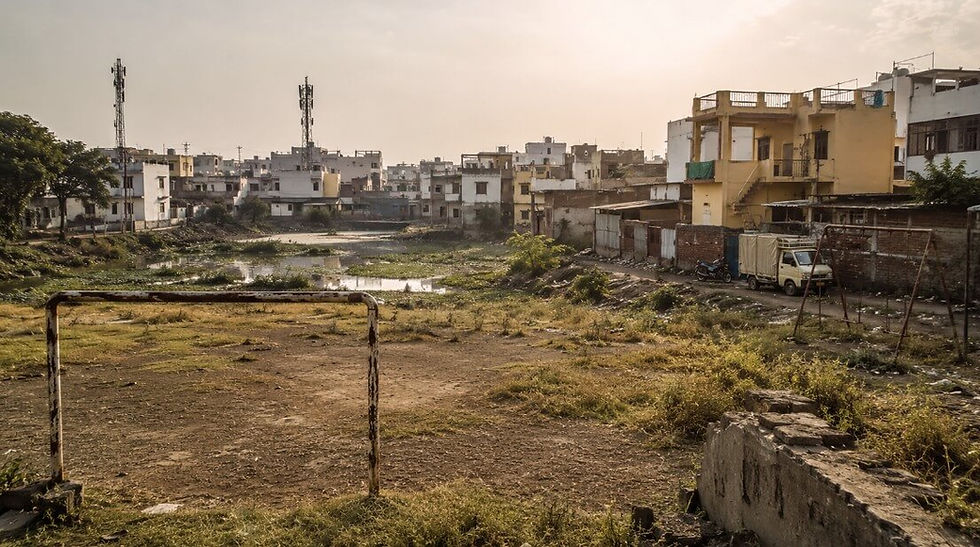
A community space does not always disappear through a visible demolition. It can be occupied gradually, repurposed, kept locked for much of the year, or neglected until residents stop using it.
In several neighbourhoods across Vidarbha, lakes, playgrounds and open grounds that once served residents have either vanished completely or lost their original public function.
Some of these places remain in official plans, old records and neighbourhood names even though the physical space has changed beyond recognition.
Others are still visible behind boundary walls, but are no longer consistently available for children, walkers or local sports groups. The distinction between physical loss and functional loss is important because both remove free and accessible places from daily neighbourhood life.
Lakes erased by encroachment and construction
1. Sanjay Nagar, Nagpur
Sanjay Nagar was once associated with a water body known as Sanjay Nagar Khadan Talao or Sanjay Gandhi Lake. The lake appeared in the Nagpur Municipal Corporation’s earlier inventory of 13 city lakes and was also included in a lake rejuvenation master plan prepared in 2008. Its presence in the plan showed that the water body was still recognised within the city’s environmental records at the time. By 2026, information obtained through the Right to Information Act showed that Sanjay Gandhi Lake was no longer present in the municipal corporation’s current list of surviving lakes. Reports linked its disappearance to settlements, encroachment and public infrastructure built on or around the former water area. An earlier report on Nagpur’s disappearing lakes stated that the Sanjay Nagar water body had been lost to settlement and construction activity, including public infrastructure. The lake therefore did not merely deteriorate or become polluted, but ceased to function as a recognisable water body. Its disappearance also removed an open neighbourhood space that could store rainwater and provide a break from dense construction. The Nagpur bench of the Bombay High Court took note of the disappearance of Sanjay Gandhi Lake and Dobi Lake in May 2026 while examining the decline of the city’s water bodies. By then, the name remained in older records, but the lake itself had been removed from the city’s active inventory.
2. Tandapeth, Nagpur
Dobi Talao once formed part of a connected system of water bodies around Tandapeth in central Nagpur. It was located near Lendi Talao and received overflow through a drainage connection involving Lendi and Naik lakes. This connection meant that Dobi Talao formed part of the local water system rather than existing as an isolated pool. As construction and informal settlements spread, much of the lake area was occupied and filled. Reporting from 2016 found that huts had already appeared over a large portion of the former water body. A later lake master plan described Dobi Talao as almost completely encroached upon, with only a very small pool left after the surrounding area was filled for development. The land was also marked for residential use in the development plan, placing its planned use in conflict with its earlier identity as a lake. By March 2026, Dobi Lake had disappeared from the municipal corporation’s list of recognised water bodies. The same official response showed that only 11 lakes were then recognised within Nagpur, while Dobi and Sanjay Gandhi lakes had dropped out of the inventory. Tandapeth consequently retained references to the old lake system even though Dobi Talao had been absorbed into the built neighbourhood.
3. Tukum, Chandrapur
Tukum is now a large residential locality in Chandrapur, but its name is tied to a lake that once occupied part of the area. Marathi reporting from 2013 listed Tukum among four central Chandrapur lakes that had disappeared because of growing encroachment. The report stated that Koneri, Ghutkala, Tukum and Gauri lakes had become extinct as the occupied water areas were converted into urban wards. It specifically recorded that encroachment on Tukum Lake led to the creation of Tukum Talao Ward. The conversion replaced a common water body with houses, roads and other permanent structures. Once the lake bed was occupied, the neighbourhood no longer had an open water edge that could function as a gathering place or shared environmental resource. The loss was part of Chandrapur’s expansion beyond its older walled settlement, during which several lakes were absorbed into new residential areas. A 2021 report in The Indian Express again named Tukum among five city lakes that had been decimated over the years. That report described the 97-acre Ramala Lake as Chandrapur’s last major surviving lake after the loss of Tukum and four other water bodies. Tukum is therefore one of the clearest cases in Vidarbha where the name of a lake continued through a ward even after the lake itself disappeared.
4. Ghutkala, Chandrapur
Ghutkala Ward developed over land associated with another of Chandrapur’s lost urban lakes. A 2013 Loksatta report stated that Ghutkala Lake had disappeared under encroachment and that the occupied area had become Ghutkala Ward. The report placed it alongside Tukum, Koneri and Gauri lakes, all of which had been lost as the city expanded. This was a physical change in land use rather than a case of a polluted lake remaining within the locality. Buildings and residential plots replaced the water area until the lake ceased to exist as an identifiable public space. The disappearance removed both the lake and the undeveloped land around it that residents could otherwise have used as an open neighbourhood area. Later reporting on Chandrapur’s surviving water bodies used the spelling Ghutwala while listing the five lakes lost before Ramala became the city’s last major lake. The older Marathi report uses the local spelling Ghutkala and directly connects the lake’s encroachment with the formation of the present ward. The ward name now preserves the historical connection even though there is no public lakefront corresponding to it. Ghutkala demonstrates how repeated construction can change a water body into a settled neighbourhood without leaving a clear physical boundary of what existed before.
Playgrounds lost to events, commercial use and neglect
5. Indora, Nagpur
Indora Maidan was described in 2020 as the largest playground in North Nagpur, covering close to 20 acres. Its size allowed football groups, local tournaments, exhibitions and neighbourhood gatherings to use the same open land. A community sports organisation had previously conducted tournaments there and operated a women’s football club on the ground. Over time, construction materials began to be stored on parts of the site and heavy vehicles regularly entered the field. The movement of trucks damaged the surface, while debris and garbage accumulated across different sections. Some construction also appeared in one corner and parked vehicles reduced the usable playing area. A sports organiser told The Times of India that “some traders who have encroached the playground do not allow sports activities”. The ground’s ownership and management were disputed between the municipal corporation, the district administration and the local housing society, leaving it without a clear custodian. One public authority said the land had not been handed over to it, while another maintained that the civic body should have taken control of the open space when the layout was sanctioned. The maidan continued to exist physically, but the combination of dumping, storage, parking, exhibitions and administrative confusion reduced its role as a reliable public playground. For one of Vidarbha’s most densely populated urban areas, the loss affected a rare large field that had earlier supported organised and informal sport.
6. Lakadganj, Nagpur
Kachhi Visa Ground in Lakadganj remains visible as an open ground, but its everyday neighbourhood function has been repeatedly displaced. The site has a jogging track and outdoor gym equipment, indicating that it was developed for public recreation and exercise. Reports from March 2026 found that it was frequently used for large gatherings and organised events instead of remaining consistently available to local children and walkers. Exhibitions and public programmes could occupy the space for extended periods. Temporary stalls were also set up before major festivals, turning the recreational ground into a seasonal commercial venue. Residents reported that the gates often remained locked when no organised activity was being held. This meant that the public could lose access both while an event occupied the land and during periods when the site was closed. The ground had therefore not disappeared from municipal maps, but its dependable use as a neighbourhood common area had weakened. It became a venue that could be activated for scheduled programmes while ordinary access remained uncertain. The Lakadganj case shows how a community space can remain physically intact and still disappear from the routine of the people living around it.
7. Vivekanand Nagar, Nagpur
The main playground near the Ram Mandir in Vivekanand Nagar once hosted cricket and handball tournaments. It had floodlights, a water connection and a seating gallery, making it suitable for organised sport as well as daily recreation. Residents said the ground served four or five surrounding colonies rather than Vivekanand Nagar alone. Years without regular maintenance caused those facilities to stop functioning properly. By May 2026, the ground had developed potholes, uneven sections, waterlogging and heavy vegetation. Tree branches had reached overhead electricity lines, while the earlier lighting and water arrangements were no longer dependable. The damaged spectator area was also reportedly being used for antisocial activity, particularly after dark. A housing society representative described the site as “the only open recreation space for four to five colonies”. Families had become reluctant to use the ground during evening hours because of poor visibility and reported activity inside the neglected structures. The land had not been sold or completely built upon, but it had lost much of the sporting and social use for which residents remembered it. Its decline converted an established community playground into an area that was present but increasingly unusable.
8. Navsari, Amravati
A 16,708-square-metre parcel in Navsari near Amravati was originally reserved as a playground under the city’s development plan. The land was transferred to the municipal corporation for the public purpose recorded in that plan. The civic body later entered agreements with third parties and began development without the approvals required for changing its use. Approximately 1,878.80 square metres was reportedly used for commercial activity from 2011. The administration subsequently directed the corporation to pay ₹10.90 crore as the value of the land and ₹3.56 crore as interest connected with the unauthorised commercial use. These actions placed the property inside a prolonged dispute involving land valuation, commercial agreements and its original playground reservation. In April 2026, the state approved the free transfer of the complete 16,708-square-metre parcel for a proposed sports complex and waived the ₹3.56 crore interest demand. The change remained subject to approval from the urban development department because the land was still reserved as a playground. During these changes, the plot was no longer a straightforward neighbourhood ground freely serving its original purpose. It existed through official files, financial liabilities and redevelopment proposals rather than as an ordinary open field available for daily community activity. Navsari remains one of the most documented cases in Vidarbha of playground land moving between public reservation, unauthorised commercial use and a planned sports project.
The disappearance of a community space is often recorded long after the change experienced by residents. A lake can remain in a master plan after houses have occupied most of its bed, while a playground can remain classified as recreational land even when it is locked, damaged or used for unrelated activity.
The names and reservations survived in several cases even after the spaces stopped working in the way local residents once knew them.
That difference between the recorded purpose and the actual condition is where many neighbourhood community spaces effectively disappeared.


Comments